
I remember back in 1980 when I was 9 years old, Mount Saint Helens was all the big news in the northwest and around the world, and for good reason. It was on May 18th of that year that this volcano sprang back to life and blew the top 1,300 feet of its top off and all around the region destroying hundreds of square miles of forest and killing 56 people in the process.
I lived overseas in Spain with my family at the time where my dad worked but as we maintained Seattle as our home-base, we followed the news closely.
Just a few weeks after the eruptions, we returned to the Washington for a few weeks visit and I remember that while traveling in the state, I was able to gather up a baby food jar of ash which I still have to this day. I also remember my parents buying me a souvenir yellow T-shirt with a picture of the volcano and the words printed, “Even saints sometimes blow their tops”. Hilarious.
Still today, St. Helens remains one of the more interesting peaks in the northwest as every few years, it seems to rumble to life again blowing off much smaller eruptions and slowly building the dome in the remaining crater.
Today, it is also popular with recreational visitors. Most visit the official visitor’s centers on the north side of the volcano that have views into the crater. When the opportunity presented itself this year however, I decided to take a more interesting look at the mountain, one from the top looking down.
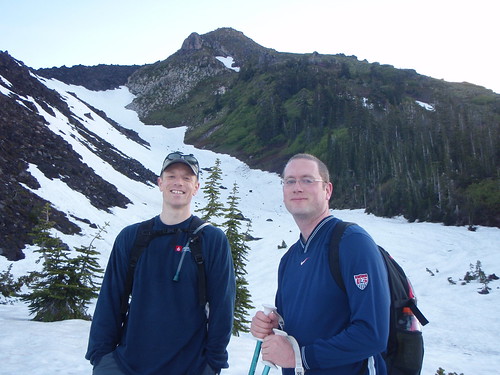
Back in February, Joe Urvina and I decided to buy permits to climb Mount St. Helens this year. We had to buy fast since only 100 permits are available per day and they sell out fast. We decided to climb on the June 20th, the longest Saturday of the year. I’ve been excited to go up there for months and had been trying to get in a bit better shape for the adventure. That time finally came last weekend. We were happy that Valerie’s cousin (my cousin-in-law?) Gordon Wilde was able to secure a permit and join us as well.
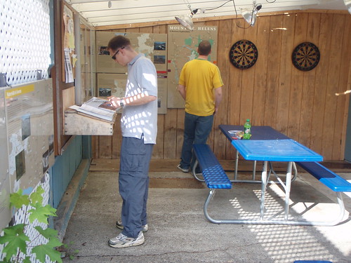
Joe and I met up at my house for the long drive down to St. Helens on Friday afternoon. We checked in at the Lone Pine Resort in Cougar, WA and met up with Gordon, picked up our permits, signed in on the climber’s register and headed on up to the mountain.
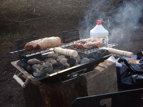
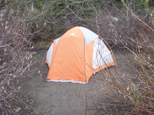
We drove from there further up the mountain and a few miles of dirt-road up to Climber’s Bivouac, the place where we would camp and spend the night. There we broke out the BBQ and grilled some man-steaks for dinner before climbing into our sleeping bags for a very short night in a very “cozy” tent.
We woke up with first light at around 4:30 AM and quickly gathered our gear together, ate a quick breakfast and hit the trail heading up. We probably were on the trail starting at just after 5:00.
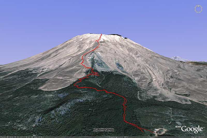
Here is our route…
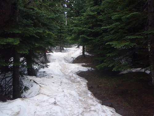
The first couple of miles were through the woods and even though there were large sections of the trail covered with slushy, spotty snow, we made very good time through here. We did have to pause at one point to take off many of the layers of clothing that we had put on earlier in the journey. We were moving fast, so we were really heating up. The higher we went, the more snow we did encounter.
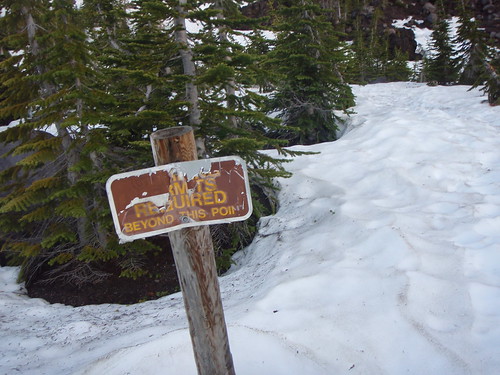
We eventually reached the tree line. This is at 4,800 feet of elevation, it is beyond this point where permits are required. From here, we had to make our way up to Monitor Ridge. This was actually kind of interesting. The climb onto the ridge was quite steep and was frozen solid, as in skating-rink solid. We were without crampons or ice axe so we had to kind of carefully pick our way up, trying not to fall and slide down into the rocks below.
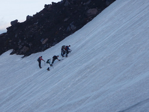
Once on Monitor Ridge, the climb became a bit of a boulder scramble for the next couple of miles as we made our way higher and higher up the mountain. This was pretty exhausting as there was quite a bit of route-finding involved as we made our way though the rough volcanic rocks. There was never really an opportunity to just turn your brain off and keep your feet going, you instead had to watch every step you took lest you twist and ankle or knee.
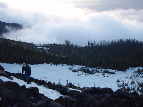
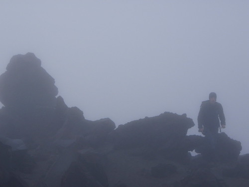
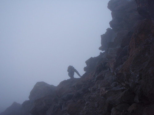
To add to the difficulty, it had become quite foggy through this section making navigation that much more difficult. It was clear to us though that when heading to the top of something, up is always a good route choice.

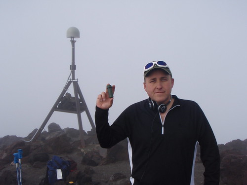
To keep things interesting for me, there was a geocache to be found at a seismic monitoring station on the way up. I believe this was probably around the 7,000 foot mark.
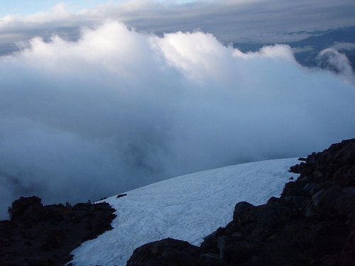
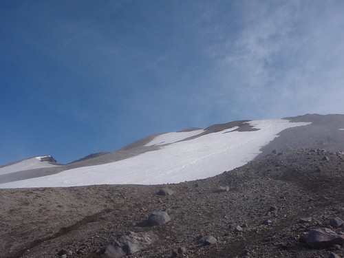
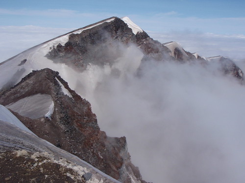
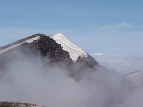
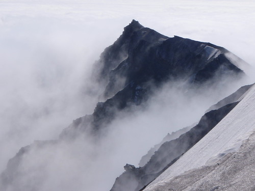
From there, we just kept heading up the mountain and eventually the boulders became smaller and smaller until we were just climbing a slope of pumice, rocks and sand. Probably somewhere between 500 and 1,000 vertical feet from the summit we finally broke out of the clouds and caught our first glimpse of the top of the mountain not far above us.
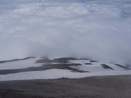
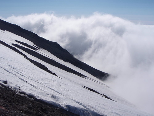
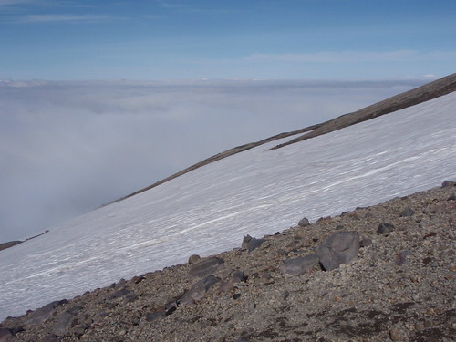
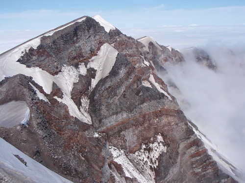
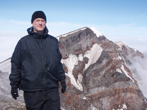
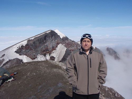
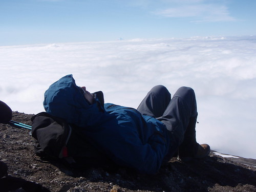
One last push and we were standing on the top. It was pretty cool to have a view of the St. Helens crater 2,000 feet below us even though, the crater itself was filled with clouds. Sitting on the summit was a bit like a view from the window of an airplane on a cloudy day. It was just a sea of clouds all around us with only three other volcanic peeks visible to us. Mt. Adams in the east, Mt. Rainier to the north, and Mt. Hood to the south.
We sat at the top for quite a while and enjoyed some lunch even though it was very cold up there when the wind blew. Having climbed so early in the morning though, we pretty much had the whole place to ourselves. We didn’t quite get the view of the crater and Spirit Lake that we had hoped for with the clouds and fog below us filling the crater but this was very beautiful in its own way. All in all, I believe it had taken us about four hours to reach the summit.

 Before too long, packed our gear back up and headed down just on time to see some more later groups starting to make their way up the scree below.
We had hoped to be able to glissade a good portion of the way down but this didn’t work out. The ice was so solid that a glissade would have probably broken the sound barrier as well as several bones. We instead picked our way back down the boulders which just killed my knees until we it was late and warm enough that the snow started to soften. We were finally able to do some glissading just before reaching tree line again.


6 comments:
Awwww, I miss mountains.
Looks awesome!
That's amazing!
Very cool, I am totally impressed!
Wow I had no idea you did that climb! How amazing. Did the kids go?
[url=http://sapresodas.net/][img]http://vioperdosas.net/img-add/euro2.jpg[/img][/url]
[b]can windows xp look like windows vista, [url=http://sapresodas.net/]buy microsoft software in[/url]
[url=http://vioperdosas.net/]adobe creative suite 4 downloads[/url] adobe photoshop clone for mac Standart Edition Mac Retail
adobe photoshop cs3 extended free trial [url=http://sapresodas.net/]filemaker pro 9 templates[/url] adobe creative suite cs3 for mac design premium
[url=http://sapresodas.net/]software purchases in[/url] free nero download
[url=http://vioperdosas.net/]adobe software education[/url] www educational software com
oem software licensing [url=http://sapresodas.net/]education software prices[/url][/b]
Post a Comment